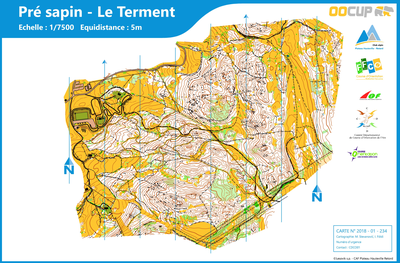


pré sapin - le terment
| Numéro : 2018-D01-234 | Carte : 1 |
| Spécialité : CO à pied | Niveau : National, International |
| Échelle : 1/7500 | Surface : 2,03 km² |
| Cartographes : m. Stevanovic, i. Foldi | |
| Commune la plus proche : haut valromey | |
| Parcours permanents : | |
| Nombre de balises : 32 | |
| Propriétaire : CAF Plateau Hauteville Retord , 01 - Ain | |
| Comment et où obtenir la carte. Responsable à contacter :
- bugey sud tourisme, site web - CDCO01, site web |
|