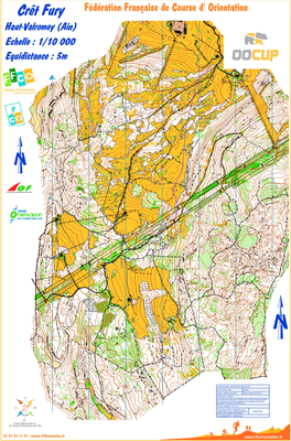


crêt Fury
| Numéro : 2020-D01-254 | Carte : 2 |
| Carte de base : 1995-D01-47 | |
| Spécialité : CO à pied | Niveau : National, International |
| Échelle : 1/10000 | Surface : 4,00 km² |
| Cartographes : sokolar, stevanovic | |
| Commune la plus proche : haut valromey | |
| Propriétaire : 01 - Ain | |
| Comment et où obtenir la carte. Responsable à contacter :
- cdco01, site web |
|