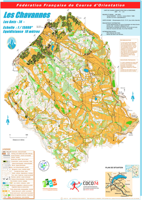


LES CHAVANNES
| Numéro : 2007-D74-113 | Carte : 1 |
| Spécialité : Rand'O | Niveau : Départemental |
| Échelle : 1/15000 | Surface : 12,76 km² |
| Cartographes : PLOCKYN Daniel | |
| Commune la plus proche : LES GETS | |
| Propriétaire : 74 - Haute-Savoie | |
| Comment et où obtenir la carte. Responsable à contacter :
- CDCO 74, , site web |
|