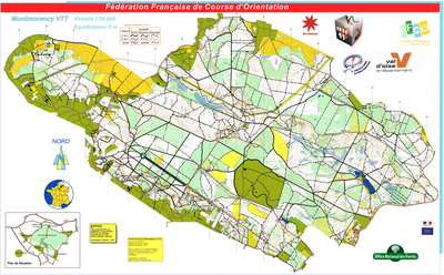


Montmorency VTT
| Numéro : 2015-D95-71 | Carte : 2 |
| Carte de base : 2005-D95-55 | |
| Spécialité : CO à VTT | Niveau : Départemental |
| Échelle : 1/20000 | Surface : 20,72 km² |
| Cartographes : Bruno LEBRAS | |
| Commune la plus proche : St-Leu-la-Forêt | |
| Propriétaire : 95 - Val-d'Oise | |
| Comment et où obtenir la carte. Responsable à contacter :
- CDCO 95, site web |
|