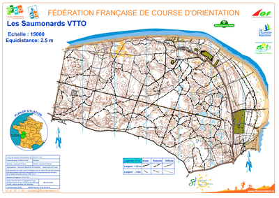


Saumonards VTTO
| Numéro : 2016-D17-120 | Carte : 2 |
| Carte de base : 2012-D17-63 | |
| Spécialité : CO à VTT | Niveau : Régional |
| Échelle : 1/15000 | Surface : 6,99 km² |
| Cartographes : Gueraud Thierry | |
| Commune la plus proche : Saint georges d'Oléron | |
| Propriétaire : 1705 - CHARENTE-MARITIME ORIENTATION | |